Atop Max Patch, a 4,600-ft. bald mountain just across the border in North Carolina, we were met with the stunning 360-degree views of the rolling Southern Appalachians we expected, an unexpected swarm of dozens — maybe hundreds — of ladybugs along the trail, and Gorf.
Gorf?
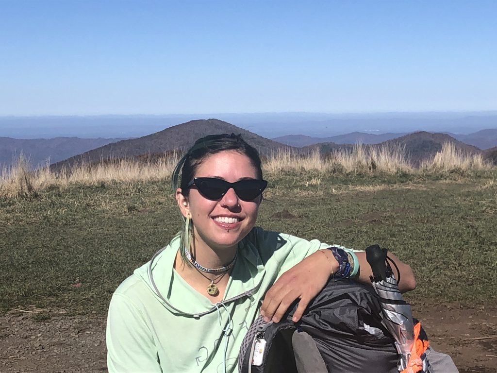
Yes. Gorf is the trail name for the Appalachian Trail thru-hiker we met on the bald, resting and eating some lunch before heading toward the Great Smoky Mountains National Park, just a few peaks away. She says her trail name started out as Frog, but she reversed it because Gorf was more creative.
Known in real life as Maddie (she didn’t offer her last name), Gorf has been hiking the AT since early June. She’s doing what she called a flip-flop hike. She started in Harpers Ferry, W.Va., hiked north to Maine, drove back to Harpers Ferry and then headed south from there. When we met, she was about 300 miles away from completion. She hopes to be back home in upstate New York before Thanksgiving.
“I got the hard stuff out of the way early,” she says, referring to the White Mountains in New Hampshire and Mt. Katahdin in Maine. “It was really hard, but incredibly rewarding,” she says.
Gorf has done a lot of the hiking alone, though she meets up regularly — particularly at night — with other thru-hikers heading her direction. “It would take a special relationship to be able to stand someone for six months on the trail,” she says. In fact, she thinks hiking alone is the way to go. “It’s easier to meet new people; if you were with someone, you’d be inhibiting yourself and sticking with the person you know.”
Toting a pack that weighs about 25 pounds, she has taken advantage of small towns, like nearby Hot Springs, NC, for a hot meal, hot shower and occasional night on a mattress. “It’s starting to get really cold at night on the trail,” she says.
She didn’t admit to being afraid alone in the wilderness, but she did say she had to learn to be by herself and to be self-reliant. And that did take some adjusting.
Her favorite part of the trail so far, she says, was in Maine. “It was so beautiful through the 100-Mile Wilderness. There were lakes to swim in almost every day, and I saw moose.” She didn’t see a bear until she hit Tennessee, where three cubs “fire poled down a tree and then skedaddled.” Her longest day hike was possibly in the Grayson Highlands in Virginia, where she did 33 miles in one day.
Her advice to anyone considering hiking the AT? “Do it. There’s no way to explain how much fun it is. Fun is not a word that begins to capture the experience.”
Still, she admits, with a laugh, “my feet always hurt.”
About Max Patch: Max Patch sits next to the Tennessee state line in the Harmon Den area of North Carolina. At 4,629 feet this bald offers 360-degree vistas of Mount Mitchell to the east and the Great Smoky Mountains to the southwest. An abundance of ferns and grasses blanket the bald, making it perfect for picnics. Pisgah National Forest personnel and volunteers are reestablishing native plants on the bald and hoping for the return of more native birds and other wildlife species.
Directions: 40 East to Harmon Den, exit 7 in North Carolina. Turn left and follow about 6-7 miles, then turn left at an unmarked intersection. The trailhead is on the right about another mile or so up the road. From that location, the hike to the summit is only about half a mile. Be warned the road is very narrow, mostly gravel and washboarded in spots.
Comments are closed.